Lerne die zehn größten Seen Sachsen-Anhalt´s im Sattel Deines Fahrrads kennen und umrunde diese. Genieße die Frische Luft und hol Dir die begehrte Sammlermedaille der Bike Lake Challenge in der Edition „Sachsen-Anhalt“.
Registration and scope of services
- Please click on the logo and you will be redirected to the registration page of our partner Digistore24
- You will now receive a registration confirmation
- Nun musst Du um die zehn größten Seen Sachsen-Anhalt´s mit dem Fahrrad umrunden. Sobald Du das geschafft hast, lade bitte einen Auszug Deines Trackings in unser Tool oder schick ihn uns per Email. Wir glauben Dir auch ohne Tracking, allerdings wirst Du dann nicht in die Bike-Lake-Museum-Ehrentabelle aufgenommen.
- After we have checked this, you will receive your well-deserved medal and marble. Easy, isn't it?
The Anmeldung zur Bike Lake Challenge Sachsen-Anhalt will cost you 24,- EUR.
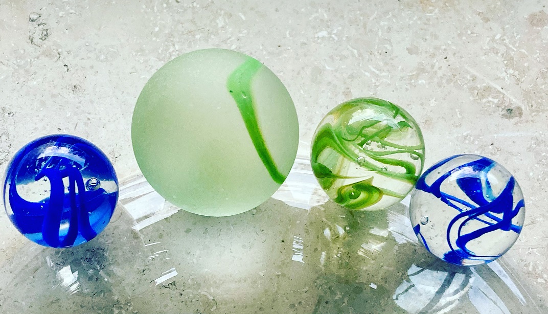
In this entry fee is our Bike Lake Challenge Edition “Sachsen-Anhalt“ Sammlermedaille and the green marble (20mm) of the Timeless Challenge . enthalten. Natürlich erhältst Du dafür auch unsere Life-Score-Points gutgeschrieben.
 |  |
Allerdings musst Du dafür erst die zehn größten Seen Sachsen-Anhalts umrunden! Only then we will send you the well-deserved medal and marble! After all, you want to earn them and not get them as a gift.
With your registration fee you support my heart project, the Reforestation of one million trees worldwide!
Rules
The rules for Bike Lake Challenge Sachsen-Anhalt sind sehr einfach. Trotzdem möchten wir sie an dieser Stelle noch einmal klarstellen:
- Melde Dich bei der Bike Lake Challenge Sachsen-Anhalt an!
- Um die Bike Lake Challenge Sachsen-Anhalt zu bezwingen und Dir die schöne Sammlermedaille zu verdienen, musst Du nach Deiner Anmeldung die zehn unten genannten Seen mit dem Fahrrad umrunden.
- Each lake must be circumnavigated "in one piece". This means that you are welcome to take breaks, but you should complete the lake within one day. Of course, you can divide the 10 lakes into different days. Do only one lake per day, because you want to enjoy this time!
- We trust you that you have really circumnavigated the lakes. However, if you want to be included in the time ranking, we need a copy of your tracking. We don't care what you use (watch, smartphone or app).
General PLEASE NOTE!
- Please note that the Road Traffic Act applies in public traffic areas and along roads and cycle paths. So move considerately.
- You circumnavigate the lakes at your own risk and at your own risk. The operator of this website assumes no liability.
- Please heed medical advice if necessary or have a medical examination before the start of the Challenge. You are responsible for your own health, equipment and condition. Breaking off a tour is not a disgrace, health always comes first!
Ein paar wichtige Regeln zum Umgang mit der Natur
- Please take into account the local instructions for the protection of nature.
- Please do not ride off the beaten track.
- Please do not make noise.
- Please do not collect rocks or minerals.
- Please do not collect mushrooms.
- Please do not leave trash lying around.
- Please do not feed animals.
- Please do not make an open fire.
- Please do not pick plants.
This should be obvious to all of us, but it doesn't hurt to remember it from time to time.
Your medal and your marble and the Life Score points
Wenn Du die zehn größten Seen Sachsen-Anhalt´s mit dem Fahrrad umrundet hast, dann hast Du Dir die wunderschöne Bike Lake Challenge “Sachsen-Anhalt Edition" medal. This can be the first in your upcoming collection from the Bike Lake Challenge. In addition, you will receive one Life Score point for the honor roll and our Life Lake Museum of the Timeless Challenge for every 20 kilometers you complete.

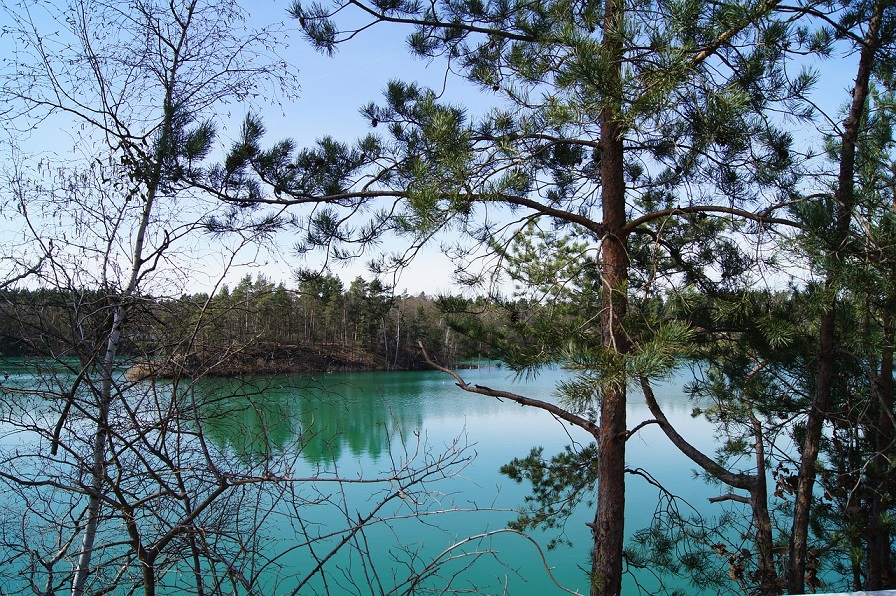
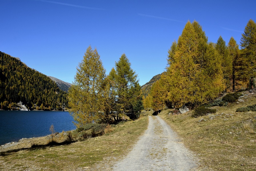
Die zehn größten Seen Sachsen-Anhalt´s
Geiseltalsee
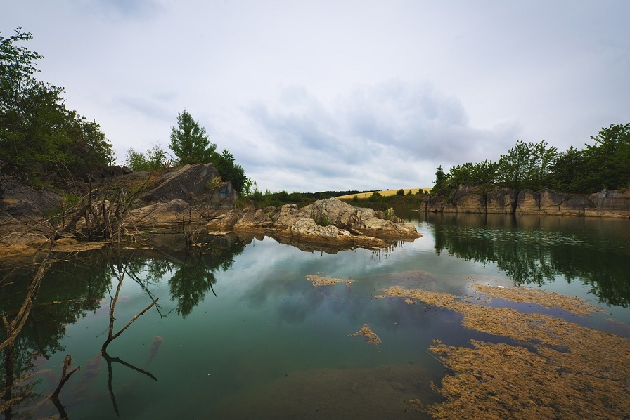
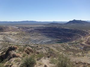
Located in southern Saxony-Anhalt (Saalekreis), Geiseltalsee is the largest artificial lake in Germany and the largest lake in Saxony-Anhalt with its 19 square kilometers. It is, as with most lakes in Saxony-Anhalt, a flooded open-cast mining lake that was recultivated and is now a beautiful recreational area.
Für eine Umrundung musst Du ca. 25 Kilometer bewältigen. Die entsprechenden Wege findest Du sicherlich sehr leicht.
Route recommendations for circumnavigation of the Geiseltal Lake
Great Goitzsche Lake
The large Goitzsee lake is also an artificial lake created by the flooding of a former open pit mine, which has been recultivated since 2002. In the meantime, the lake has been opened for tourist use and is very popular with local residents.
For the circumnavigation of the large Goitzsee you have to cover just over 30 kilometers, but in the meantime it is worth it, because it is beautiful there!
Route recommendations for circumnavigating the large Goitzsee lake
Muldestausee
Der Muldestausee ist ebenfalls ein gefluteter Tagebau mit ca. 9 Kilometer Länge und zwei Kilometer Breite (an der breitesten Stelle). Allerdings wurde er bereits in den Jahren 1975/1976 geflutet, so dass man von außen kaum sehen kann, dass dieser See nicht natürlichen Ursprungs ist. Er liegt im Landkreis Anhalt-Bitterfeld. Für die Umrundung musst Du ca. 17 Kilometer absolvieren.
Route recommendations for circumnavigating the Mulde Reservoir:
Arendsee
Arendsee is one of the most popular lakes in Germany. It is the largest and deepest natural lake in Saxony-Anhalt. It is also interesting that it is located on a salt dome, which has broken away over the years by the groundwater (subrosion). On its shores you can look forward to untouched nature with a rich flora and fauna. For the circuit you have to calculate with about 10 kilometers of shore.
Route recommendations for circumnavigating the Arendsee:
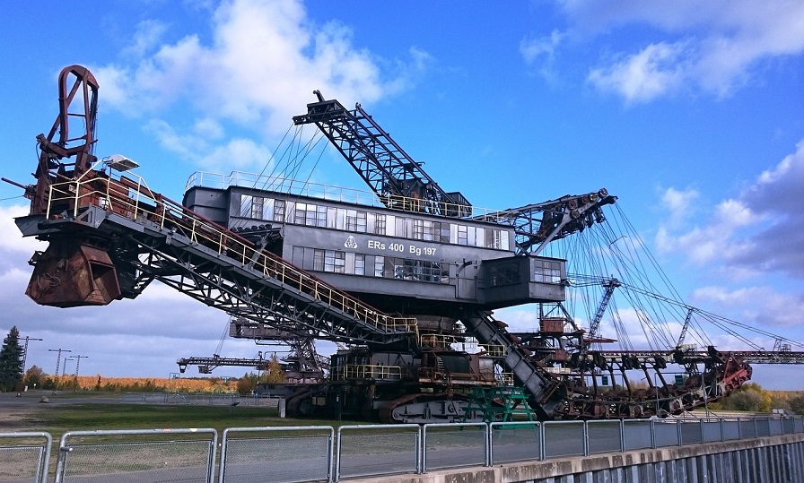
Gremmin lake
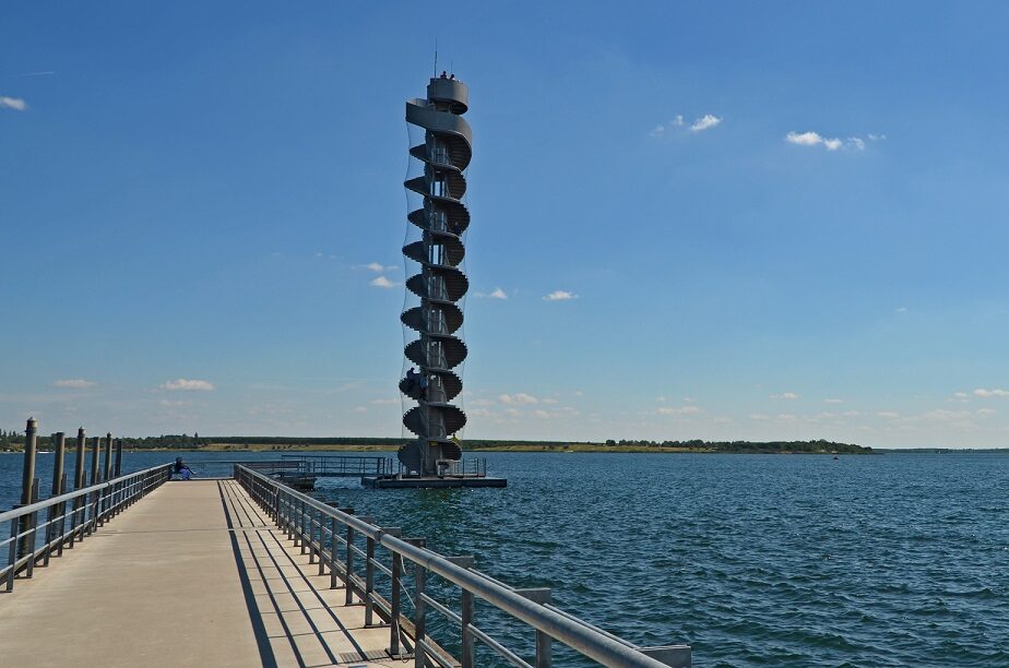
Der Gremminer See oder Ferropolissee ist ebenfalls aus einem gefluteten Tagebau entstanden und ist damit ein Tagebaurestsee. Auf einer Halbinsel befinden sich, weithin sichtbar fünf große Tagebaugroßgeräte (Bagger) die im Rahmen des „Freilichtmuseums Ferropolis“ ausgestellt werden.
Circumnavigation of the Gremminer Lake is possible via a circular trail with a length of about 13 kilometers.
Route recommendations for circumnavigation of the Gremminer Lake:
Lake Concordia
Der Name stammt von der ehemaligen Braunkohlegrube „Concordia“. Der Concordiasee gehört zum Harzer Seenland und ist der Größte dort. Aufgrund eines Erdrutsches sind derzeit nur das Nordufer zur Nutzung für Wassersport und den Badebetrieb freigegeben. Das Südufer bleibt gesperrt. Eine Umrundung ist jedoch möglich. Dafür musst Du ca. 13 Kilometer zurücklegen.

Routenempfehlungen zur Umrundung des Concordia Sees
Lake Gröbern
Lake Gröbern was also created from an open pit mine that was flooded. It is one of the northernmost lakes in the Central German Lake District. A few years ago, a 100,000-year-old forest elephant was found in the former Gröbern open pit mine, which can now be admired in the State Museum of Prehistory in Halle. Today, the forest elephant would have to walk about 14 kilometers to circumnavigate Lake Gröbern.
Route recommendations for circumnavigation of the lake Gröbern
Wallendorf lake
Auch der Wallendorfer See entstand als sogenannte „Bergbaufolgelandschaft“ aus dem ehemaligen Braunkohlebau Merseburg Ost. Die touristischen Angebote rund um den See sind mau, aber trotzdem lohnt sich ein Besuch der Region, denn um den Wallendorfer See herum gibt es zahlreiche Seen und kleine Städte die auf alle Fälle einen Besuch wert sind. Eine Umrundung des Wallendorfer Sees kostet Dich ca. 12 Kilometer.
Route recommendations for circumnavigation of the Wallendorf Lake
Rappbode Dam
Die Rappbodetalsperre liegt im Harz, nahe dem berühmten Bodden und ist ein Wasserkraftwerk. Die Rappbodetalsperre ist 415 Meter lang und mit einer Höhe von 106 Metern gleichzeitig die größte Talsperre in Deutschland. Wenn Du sie umrunden möchtest, dann musst Du ca. 26 Kilometer! zurücklegen. Das liegt an der Topographie der Landschaft hier. Lass Dir die berühmte Hängebrücke nicht entgehen!
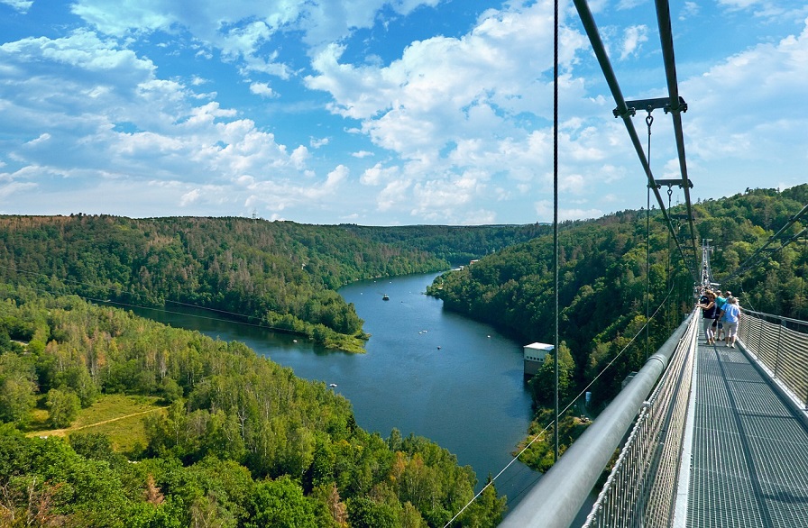
Route recommendations for circumnavigating the Rappbode Dam
Raßnitzer See
Der Raßnitzer See liegt in unmittelbarer Nachbarschaft zum Wallendorfer See, bietet sich also für eine gemeinsame Umrundung an. Auch er gehört zur lokalen „Bergbaufolgelandschaft“, hervorgegangen aus der Flutung eines ehemaligen Tagebaus. Eine Umrundung kostet Dich ziemlich genau 10 Kilometer.
Route recommendations for circumnavigation of the lake Raßnitz
BIKE LAKE CHALLENGE Sachsen-Anhalt EHRENTAFEL
Here you can quickly and easily enter your results and upload the evidence (e.g. screen copy of your tracking). We check them and approve them. Then your result is saved and appears in the honor roll.
Instructions for the Challenge Tool
This is how our honor board works
- Register on our site
- Select the lake you are circling under "Lake"
- Enter the distance you have covered (in meters) under "Length (in m)"
- Enter the required time (in minutes) under "Time needed (in min).
- Enter the date of your circumnavigation under "date"
- Now you can upload the evidence (e.g. a screenshot of your tracking) under "Upload proof (optional)"
- Now all you have to do is SAVE!
- We check your round and release it. Then you will see your result in the ranking.
Points
THE BIKE LAKE CHALLENGE IN SOCIAL MEDIA
Join our forum
Exchange ideas in our community! Our forum for experiences, reports, questions and more
HASHTAGS OF THE BIKE LAKE CHALLENGE
We would be delighted if you shared pictures, videos and your experiences of the Bike Lake Challenge with others. We provide you with the following hashtags for this purpose:
- #bikelakechallenge
- #bikelakechallengesachsen-anhalt
- #timelesschallenge
- #timelesschallenger
THE BIKE LAKE CHALLENGE ON FACEBOOK
Of course we also invite you to join our Facebook group "Bike Lake Challenge Discussion Board".