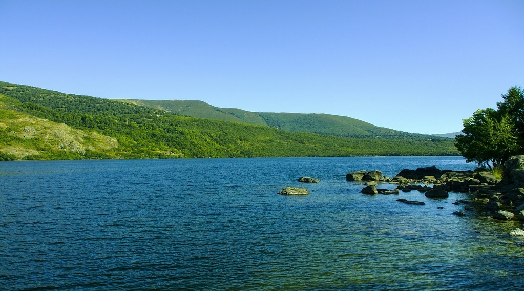
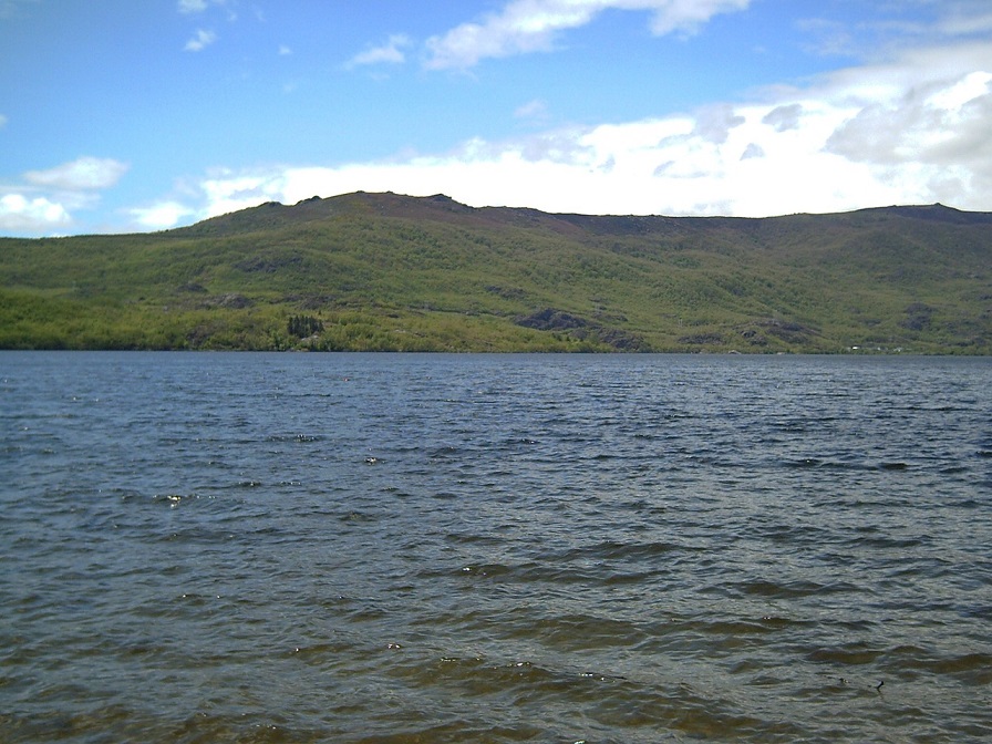
Wenn wir an Spanien denken, dann denken wir meistens an Strand, Meer und berühmte Metropolen. Doch Spanien hat noch viel mehr zu bieten. So hat Spanien mehr als 2500 Seen, wobei die Meisten in der „Extremadura“ liegen. Die zehn größten Seen Spaniens sind meist zur Sicherung der Trinkwasservorräte künstlich angelegt und sie zu umrunden (das Ziel der Iron Lake Challenge Spanien) ist ein echtes Abenteuer, denn Du findet bisher noch wenig Informationen über optimale Routen und so genießt der Entdeckergeist die volle Freiheit. Die Iron Lake Challenge Spanien ist ein echtes Abenteuer! Deshalb wirst Du Deine persönliche Route finden und wir sind dankbar, wenn Du sie mit uns (am Liebsten in Form einer .gpx-Datei) mitteilst.
RULES
- Sign up for the Iron Lake Challenge Spain!
- To conquer the Iron Lake Challenge Spain and earn the beautiful collector's medal, you have to walk around the ten largest lakes in Spain after registering.
- Bicycles, skates, etc. are not allowed, but you are welcome to hike or run.
- Each lake must be circumnavigated "in one piece". This means that you are welcome to take breaks, but you should complete the lake in one day, unless there is a special regulation for certain lakes. There are lakes that are too big for a one-day tour, for these you may take several days. Of course, you can (and must) divide the circumnavigations of the 10 lakes into different days. Do only one lake per day, because you want to enjoy this time! You have no time limit for this challenge, which means that you can take several years.
- We trust you that you have really circumnavigated the lakes. However, if you want to be included in the time ranking, we need a copy of your tracking. We don't care what you use (watch, smartphone or app).
General PLEASE NOTE!
- Please note that the road traffic regulations apply in public traffic areas and along roads and cycle paths. So move with consideration.
- You circumnavigate the lakes at your own risk and at your own risk. The operator of this website assumes no liability.
- Please heed medical advice if necessary or have a medical examination before the start of the Challenge. You are responsible for your own health, equipment and condition. Breaking off a tour is not a disgrace, health always comes first!
IMPORTANT RULES FOR DEALING WITH NATURE DURING YOUR LAKE TOUR:
- Please take into account the local instructions for the protection of nature.
- Please do not go off the trails.
- Please do not make noise.
- Please do not collect rocks or minerals.
- Please do not collect mushrooms.
- Please do not leave trash lying around.
- Please do not feed animals.
- Please do not make an open fire.
- Please do not pick plants.
This should be obvious to all of us, but it doesn't hurt to remember it from time to time.
REGISTRATION AND SCOPE OF SERVICES
Registration for the Iron Lake Challenge Spain costs you 24,- EUR.
In this entry fee is our Iron Lake Challenge “Spain Edition” Collector's medal and the green marble (20mm) of the Timeless Challenge . .
However, you first have to circumnavigate the ten largest lakes in Spain! Only then we will send you the well-deserved medal and marble! After all, you want to earn them and not get them as a gift.
With your registration fee you support my heart project, the Reforestation of one million trees worldwide!
THIS IS HOW YOU CAN REGISTER:
- Please click on the logo and you will be redirected to the registration page of our partner Digistore24
- After booking the Iron Lake Challenge you will receive a confirmation of registration
- Now you have to walk around the ten largest lakes in Spain. As soon as you have completed this, please send us an extract of your tracking as proof. We will also believe you without tracking, but then you will not be included in the Iron Lake Roll of Honor.
- After we have checked this, you will receive your well-deserved medal and marble. Easy, isn't it?
YOUR MEDAL AND YOUR MARBLE
If you have circumnavigated the ten largest lakes in Spain on foot, then you have completed the wonderful Iron Lake Challenge "Spain Edition"Medal earned. This can be the first in your upcoming collection from the Iron Lake Challenge.
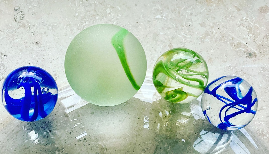
LIFE SCORE POINTS AND THE TIMELESS MARBLE
The Iron Lake Challenge is part of our .. Therefore, you deserve (in addition to the collector's medal) the marble in green (health/sport). This will also be sent to you. The marble will have a diameter of 20mm.

You earn with your performance ca. 90 Life Score Punkte. These will be added to both the Spain Roll of Honor and the Life Lake Museum . This service is free of charge for you.
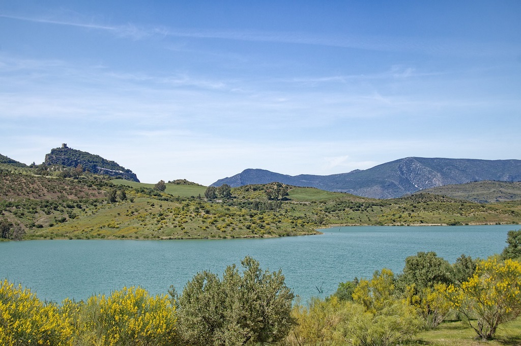
The ten largest lakes in Spain
Eigentlich ist das „Mar Menor“, eine riesige Salzwasserlagune der größte See Spaniens und trotzdem fehlt er in unserer Liste. Das liegt daran, dass er nicht ohne Schwimmen umrundet werden kann, da er einen Zugang zum Meer hat. Aber wir haben zehn spannende Seen für Dich und zusätzlich (als Möglichkeit noch mehr Life-Score Points zu verdienen noch drei weitere.
La Serena reservoir
Der La-Serena-Stause ist mit seinen 139,49 km² (13.949 Hektar) der größte (Stau)see Spaniens und liegt in der Provinz Badajoz (südliches Zentralspanien). Eigentlich handelt es sich um zwei Stauseen, denn der obere La-Sererna-Stausee hängt mit dem kleineren Zuja-Stausee zusammen. Für die Challenge ist aber „nur“ der obere La-Serena Stausee entscheidend. Leider haben wir für die Umrundung des riesigen La-Serena Stausees nur einen weitläufigen Weg über Google Maps gefunden. Wir sind uns aber sicher, dass die Wirklichkeit weitaus bessere und näher am Wasser gelegene Wege bietet. Wenn Du hier eine erste .gpx-Datei erstellen konntest, freuen wir uns sehr wenn Du sie mit uns teilst. Für eine vollständige Umrundung sind ca. 150 Kilometer notwendig. Du hast hierfür allerdings vier Tage Zeit.
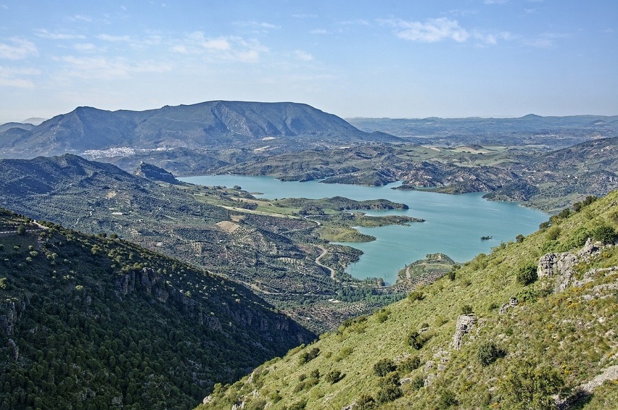
Recommended route around the La Serena reservoir (Google Maps)
Almendra Dam
The 137 km² (13,700 hectare) Almendra Reservoir is the highest reservoir in Spain and is located near the town of Almendra (provinces of Salmanaca and Samora). The dam wall impounds the river Tormes. This huge reservoir will challenge you, as you have to plan to walk around it for around 100 kilometers.

Recommended route around the Almendra reservoir (Google Maps)
Alcantara Reservoir
Der 104 km² (10.400 Hektar) große Alcantara Stausee staut den längsten Fluss auf der iberischen Halbinsel, den Tajo. Er liegt in der Nähe der Stadt Alcantara und heißt eigentlich „Embalse de José María de Oriol-Alcántara II„. Dieser Stausee ist international berühmt für seinen reichen Fischbestand und als hervorragendes Angelgewässer. Der Stausee ist riesig und kann nur relativ weiträumig umrundet werden. Du musst für eine Umrundung zu Fuß ca. 130 Kilometer bewältigen. Dafür hast Du drei Tage Zeit.
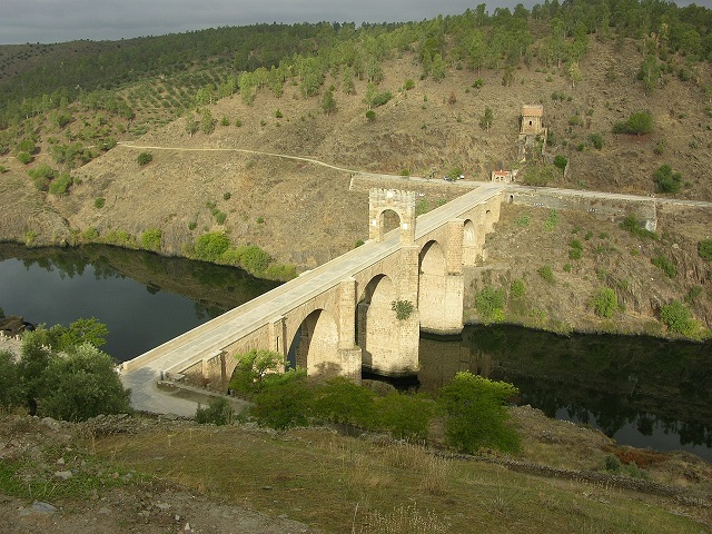
Route recommendations for circumnavigating the Alcantara reservoir (Google Maps)
Buendia reservoir
The 82 km² (8200 hectare) Buendia reservoir (Presa de Buendía) dams the Rio Guadiela near the town of Buendia in central Spain. On your route around the reservoir, you will find around 20 interesting sculptures and bas-reliefs carved into the stone. This lake will also challenge you on the circumnavigation, as you also have to cover 91 kilometers on foot here.
Route recommendations for circumnavigating the Buendia reservoir (Google Maps)
Embalse de Mequinenza
With its 75.4 km² (7540 hectares), the Mequinenza reservoir is the largest reservoir in the Aragon region. It dams the Ebro in the province of Zaragoza. The reservoir is particularly popular with sport fishermen. But a walk around it also has its charm. When planning the circumnavigation using Google Maps, we only found one long route (approx. 180 kilometers). But this reservoir wants to be explored and we are sure that there is also a shorter route.
Suggested tour around the Mequinenza reservoir (Google Maps)
Embalse de Valdecañas
The 73 km² (7300 hectare) Valdecañas reservoir dams the Rio Tajo in the east of the province of Cáceres. As you walk around it, you can see a few remains of the old Roman town of Augustobriga. Most of it was flooded during the construction of the dam and is now under water. The art of circumnavigating the reservoir is to find a crossing over the Tagus. If you follow the official route, you have to cross it at El Puente del Arzorbispo and take a small detour. But we are sure you will find another way. As soon as we are informed of a new route, we will publish it immediately
Suggested tour around the Valdecanas reservoir (Google Maps)
Alarcón Dam
Mit ihren 68,40 km² (6840 Hektar) ist die „Presa de Alarcón“ (spanischer Name) der siebtgrößte See Spaniens. Die Talsperre liegt in Zentralspanien und gehört zu der Provinz Cuenca. Der Stausee wird sowohl zur Stromerzeugung als auch zur Sicherung des Trinkwassers verwendet. Er befindet sich in Staatsbesitz. Um die Talsperre Alarcón zu Fuß zu umrunden musst Du ca. 100 Kilometer zurücklegen. Dafür hast Du drei Tage Zeit.
Suggested route around the Presa de Alarcón (Google Maps)
Cíjara reservoir
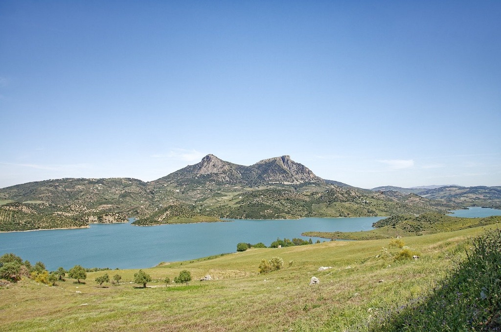
Die „Presa de Cíjara (spanischer Name) staut den Rio Guadiana und bildet so einen ca. 65 km² (6500 Hektar) großen Stausee. Sie wird sowohl zur Stromversorgung als auch zur Bewässerung und für die Sicherung der Trinkwasserversorgung verwendet. Sie liegt zentral in Spanien in dem „Cíjara National Hunting Reserve“, einem wunderschönen Naturschutzgebiet in dem Hirsche, Wildschweine, Damwild, Otter, Adler, Rebhühner, Luchse, Schwarzstörche zu sehen sind. Um sie zu Fuß zu umrunden musst Du ca. 83 Kilometer (je nach Route) zurücklegen. Dafür hast Du jedoch drei Tage Zeit.
Suggested route around the Cíjara reservoir (Google Maps)
Presa de Ricobayo
The Ricobayo dam, with its 57 km² (5700 hectares) of water, is another of Spain's water giants. It is located in Castile (province of Zamora) and its construction began back in 1929. It has since been enlarged several times. This giant will also challenge you, as you have to walk around it for around 100 kilometers (depending on the route). You have three days to do this.
Suggested route around the Presa de Ricobayo reservoir (Google Maps)
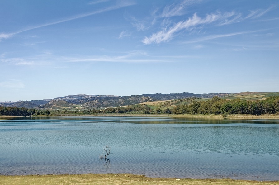
Embalse de Alange
The Alange Reservoir is another large reservoir in Spain with a water surface area of 51.44 km² (5144 ha). It is located on the Matachel River, near where it flows into the Guadiana. Its construction was carried out to provide water for the irrigation of crops near the Guadiana plain. If you want to walk around it, there are about 60 kilometers waiting for you.

Suggested tour around the Alange reservoir (Google Maps)
We also recommend these lakes
You can collect additional Life Score points with the following three lakes. We have listed these lakes because they are really worth seeing and are among Spain's most beautiful areas. So see it as an opportunity. However, you only need the upper lakes for the medal.
Albufera Lagun
Die Albufera Lagune ist etwas ganz Besonderes, denn sie ist eine ausgesüßte Lagune, also ein Strandsee. Früher war sie eine Salzwasserlagune. Doch dann lagerte sich immer mehr Sand ab, so dass immer weniger Meereswasser eindringen konnte und die Lagune immer mehr von Süßwasser dominiert wurde, bis sie schließlich „ausgesüßt“ war. Sie liegt am Golf von Valencia und ist Teil des 21.120 Hektar großen Parc Natural de l’Albufera de València („Valencianischer Albufera-Naturpark“). Eine Umrundung der Albufera Lagune ist anspruchsvoll (ca. 60 Kilometer), aber sie ist wunderschön.
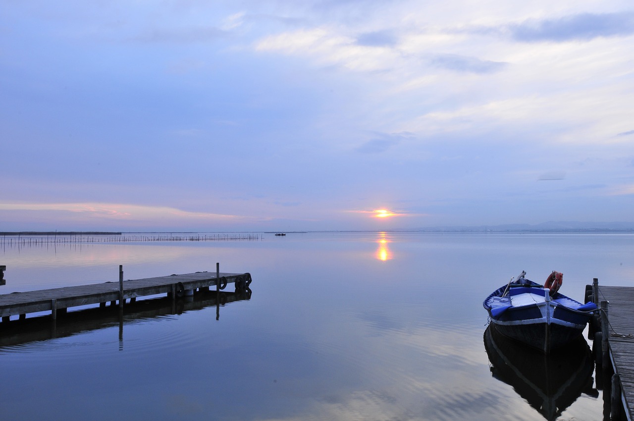
Tour tip for circumnavigating the Albufera Lagoon
Lago de Sanabria
Mit seiner 3,5 Quadratkilometer (369 Hektar) großen Wasserfläche gehört der Lago de Sanabria zu den größten Seen Spaniens. Er liegt im Nationalpark „Parque Natural del Lago de Sanbria y Alrededores“. Aus diesem Grund bitten wir Dich die Wege nicht zu verlassen und auf die Natur zu achten! Zu finden ist dieser See in der autonomen, historisch wertvollen Gemeinderegion von Kastilien-Leon. Der Rundweg ist ca. 13 Kilometer lang.
Tour recommendations for the circumnavigation of Lago de Sanabria
Estany de Banyoles
The Estany de Banyoles is considered one of the most important and most touristic lakes in Spain and is the largest lake in Catalonia. This recreational area is popular with locals as well as day-trippers and vacationers for its hiking and cycling trails that circle the lake. It is 2100 meters long and 750 meters wide, covering an area of 1.12 km². Unfortunately, the circuit is only seven kilometers long, but it is beautiful.
Tour recommendations for the circumnavigation of the Estany de Banyoles
- Komoot - Circumnavigation of the Estany de Banyoles
- AllTrails - Circumnavigation of the Estany de Banyoles
THE IRON LAKE CHALLENGE IN SOCIAL MEDIA
Join our forum
Exchange ideas in our community! Our forum for experiences, reports, questions and more
HASHTAGS OF THE IRON LAKE CHALLENGE SPAIN
We would be happy if you share pictures, videos and your experiences around the Iron Lake Challenge with others. For this purpose we provide you with the following hashtags:
- #ironlakechallenge
- #ironlakechallengeespana
- #timelesschallenge
The IRON LAKE CHALLENGE ON FACEBOOK
Of course we also invite you to join our Facebook group "Iron Lake Challenge Discussion Board".
Iron Lake Challenge Spain Honor Roll
Here you can quickly and easily enter your results and upload the evidence (e.g. screen copy of your tracking). We check them and approve them. Then your result is saved and appears in the honor roll.
Instructions for the Challenge Tool
This is how our honor board works
- Register on our site
- Select the lake you are circling under "Lake"
- Enter the distance you have covered (in meters) under "Length (in m)"
- Enter the required time (in minutes) under "Time needed (in min).
- Enter the date of your circumnavigation under "date"
- Now you can upload the evidence (e.g. a screenshot of your tracking) under "Upload proof (optional)"
- Now all you have to do is SAVE!
- We check your round and release it. Then you will see your result in the ranking.