Saxony Anhalt is famous for its historic cities and buildings, but this small state can do much more. Many of the towns and Central German Lake District ("Mitteldeutschen Seenland") gehörenden Seen liegen in Sachsen Anhalt und die meisten davon sind ehemalige Bergbaugruben die als „Bergbaufolgelandschaft“ geflutet wurden und zu wunderbaren Naherholungsgebieten wurden oder derzeit dazu werden. Es ist spannend zu sehen wie lange es dauert(e), bis sich die Natur die ehemaligen Bergbauwüsten wieder zurückholt.
If you want to understand and get to know this state, then you should walk around the ten largest lakes in Saxony-Anhalt, keep your eyes open and visit the nearby villages. Experience how nature forgives even the greatest sins of the past and recovers everything if you let it.
Join the Iron Lake Challenge Saxony-Anhalt and go around the ten largest lakes of this beautiful state. On more than 170 shore kilometers you will experience Saxony-Anhalt where it is most beautiful.
RULES
The rules for the Iron Lake Challenge "Saxony-Anhalt" are very simple. Nevertheless, we would like to clarify them again at this point:
- Melde Dich bei der Iron Lake Challenge Sachsen-Anhalt an!
- To conquer the Iron Lake Challenge Saxony-Anhalt and earn the beautiful collector's medal, you have to walk around the ten largest lakes in Saxony-Anhalt (see below) after your registration.
- Bicycles, skates, etc. are not allowed, but you are welcome to hike or run.
- Each lake must be circumnavigated "in one piece". This means that you are welcome to take breaks, but you should complete the lake within one day. Of course, you can divide the 10 lakes into different days. Do only one lake per day, because you want to enjoy this time!
- We trust you that you have really circumnavigated the lakes. However, if you want to be included in the honor roll, we need a copy of your tracking. We don't care what you use (watch, smartphone or app).
General PLEASE NOTE!
- Please note that the Road Traffic Act applies in public traffic areas and along roads and cycle paths. So move considerately.
- You circumnavigate the lakes at your own risk and at your own risk. The operator of this website assumes no liability.
- Please heed medical advice if necessary or have a medical examination before the start of the Challenge. You are responsible for your own health, equipment and condition. Breaking off a tour is not a disgrace, health always comes first!

A few rules for dealing with nature during your lake tour:
- Please take into account the local instructions for the protection of nature.
- Please do not go off the trails.
- Please do not make noise.
- Please do not collect rocks or minerals.
- Please do not collect mushrooms.
- Please do not leave trash lying around.
- Please do not feed animals.
- Please do not make an open fire.
- Please do not pick plants.
This should be obvious to all of us, but it doesn't hurt to remember it from time to time.
REGISTRATION AND SCOPE OF SERVICES
The registration for the Iron Lake Challenge Saxony-Anhalt costs you 24,- EUR.
In this entry fee is our Iron Lake Challenge “Sachsen-Anhalt“ Sammlermedaille and the green marble (20mm) of the Timeless Challenge .
However, for this you first have to go around the ten largest lakes of this beautiful state! Only then we will send you the well-deserved medal and marble! After all, you want to earn them and not get them as a gift.
With your registration fee you support my heart project of the Reforestation of one million trees worldwide!
How to register:
- Please click on the Bild unten und Du wirst zur Anmeldeseite unseres Partners Digistore24 geleitet
- You will now receive a registration confirmation
- Nun musst Du um die zehn größten Seen Sachsen-Anhalts zu Fuß. Sobald Du die zehn Seen geschafft hast, schick uns bitte einen Auszug Deines Trackings als Nachweis. Gerne kannst Du auch unser Tool (siehe „Ehrentafel“ auf dieser Seite) nutzen!
- After we have checked this, you will receive your well-deserved medal and marble. Easy, isn't it?
YOUR MEDAL AND YOUR MARBLE
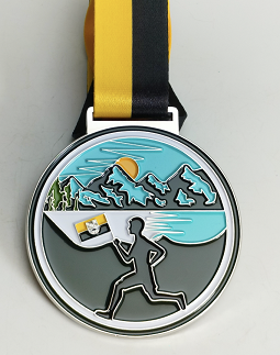
If you have walked around the ten largest lakes in Saxony-Anhalt, then you have earned the beautiful Iron Lake Challenge "Saxony-Anhalt Edition" medal. This can be the first in your upcoming Iron Lake Challenge collection, or it can complement the ones you already have.

LIFE SCORE POINTS AND THE TIMELESS MARBLE
The Iron Lake Challenge is part of our Timeless Challenge. Therefore, you deserve (in addition to the collector's medal) the marble in green (health/sport). This will also be sent to you. The marble will have a diameter of 25mm.

You earn with your performance ca. 17 Life Score Punkte. These will be presented to both the Ehrentafel Sachsen-Anhalt, as well as the Life Lake Museum credited.
THE TEN LARGEST LAKES IN SAXONY-ANHALT
Geiseltalsee
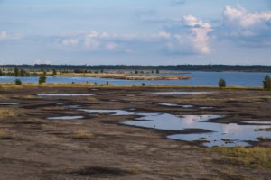
Located in southern Saxony-Anhalt (Saalekreis), Geiseltalsee is the largest artificial lake in Germany and the largest lake in Saxony-Anhalt with its 19 square kilometers. It is, as with most lakes in Saxony-Anhalt, a flooded open-cast mining lake that was recultivated and is now a beautiful recreational area.
For a circumnavigation you need to walk about 25 kilometers. You will certainly find the appropriate paths very easily.
Route recommendations for circumnavigation of the Geiseltal Lake
Great Goitzsche Lake
The large Goitzsee lake is also an artificial lake created by the flooding of a former open pit mine, which has been recultivated since 2002. In the meantime, the lake has been opened for tourist use and is very popular with local residents.
For the circumnavigation of the large Goitzsee you have to cover just over 30 kilometers, but in the meantime it is worth it, because it is beautiful there!
Route recommendations for circumnavigating the large Goitzsee lake
Muldestausee
The Muldestausee is also a flooded open pit mine with a length of about 9 kilometers and a width of two kilometers (at the widest point). However, it was already flooded in the years 1975/1976, so that one can hardly see from the outside that this lake is not of natural origin. It is located in the district of Anhalt-Bitterfeld. For the circumnavigation on foot you have to complete about 17 kilometers.
Route recommendations for circumnavigating the Mulde Reservoir:
Arendsee
Arendsee is one of the most popular lakes in Germany. It is the largest and deepest natural lake in Saxony-Anhalt. It is also interesting that it is located on a salt dome, which has broken away over the years by the groundwater (subrosion). On its shores you can look forward to untouched nature with a rich flora and fauna. For the circuit you have to calculate with about 10 kilometers of shore.
Route recommendations for circumnavigating the Arendsee:
Gremmin lake
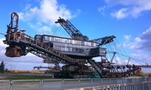
Der Gremminer See oder Ferropolissee ist ebenfalls aus einem gefluteten Tagebau entstanden und ist damit ein Tagebaurestsee. Auf einer Halbinsel befinden sich, weithin sichtbar fünf große Tagebaugroßgeräte (Bagger) die im Rahmen des „Freilichtmuseums Ferropolis“ ausgestellt werden.
Circumnavigation of the Gremminer Lake is possible via a circular trail with a length of about 13 kilometers.
Route recommendations for circumnavigation of the Gremminer Lake:
Lake Concordia
Der Name stammt von der ehemaligen Braunkohlegrube „Concordia“. Der Concordiasee gehört zum Harzer Seenland und ist der Größte dort. Aufgrund eines Erdrutsches sind derzeit nur das Nordufer zur Nutzung für Wassersport und den Badebetrieb freigegeben. Das Südufer bleibt gesperrt. Eine Umrundung ist jedoch möglich. Dafür musst Du ca. 13 Kilometer zu Fuß zurücklegen.
Routenempfehlungen zur Umrundung des Concordia Sees
Lake Gröbern
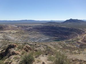
Lake Gröbern was also created from an open pit mine that was flooded. It is one of the northernmost lakes in the Central German Lake District. A few years ago, a 100,000-year-old forest elephant was found in the former Gröbern open pit mine, which can now be admired in the State Museum of Prehistory in Halle. Today, the forest elephant would have to walk about 14 kilometers to circumnavigate Lake Gröbern.
Route recommendations for circumnavigation of the lake Gröbern
Wallendorf lake
Auch der Wallendorfer See entstand als sogenannte „Bergbaufolgelandschaft“ aus dem ehemaligen Braunkohlebau Merseburg Ost. Die touristischen Angebote rund um den See sind mau, aber trotzdem lohnt sich ein Besuch der Region, denn um den Wallendorfer See herum gibt es zahlreiche Seen und kleine Städte die auf alle Fälle einen Besuch wert sind. Eine Umrundung des Wallendorfer Sees zu Fuß kostet Dich ca. 12 Kilometer.
Route recommendations for circumnavigation of the Wallendorf Lake
Rappbode Dam
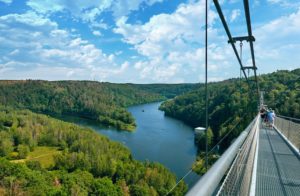
The Rappbode Dam is located in the Harz Mountains, near the famous Bodden and is a hydroelectric power plant. The Rappbode Dam is 415 meters long and with a height of 106 meters at the same time the largest dam in Germany. If you want to go around it, you have to walk about 26 kilometers! This is due to the topography of the landscape here. Don't miss the famous suspension bridge!
Route recommendations for circumnavigating the Rappbode Dam
Raßnitzer See
Der Raßnitzer See liegt in unmittelbarer Nachbarschaft zum Wallendorfer See, bietet sich also für eine gemeinsame Umrundung an. Auch er gehört zur lokalen „Bergbaufolgelandschaft“, hervorgegangen aus der Flutung eines ehemaligen Tagebaus. Eine Umrundung kostet Dich ziemlich genau 10 Kilometer.
Route recommendations for circumnavigation of the lake Raßnitz
Join our forum
Exchange ideas in our community! Our forum for experiences, reports, questions and more

Iron Lake Challenge Sachsen-Anhalt Ehrentafel
Here you can quickly and easily enter your results and upload the evidence (e.g. screen copy of your tracking). We check them and approve them. Then your result is saved and appears in the honor roll.
Instructions for the Challenge Tool
This is how our honor board works
- Register on our site
- Please reload this page (so that the system recognizes that you are logged in)
- Select the lake you are circumnavigating under "Summit/Lake
- Enter the distance you have covered (in meters) under "Length / Mountain height (in m)"
- Enter the required time (in minutes) under "Time needed (in min).
- Enter the date of your circumnavigation under "date"
- Now you can upload the evidence (e.g. a screenshot of your tracking) under "Upload proof (optional)"
- Now all you have to do is SAVE!
- We check your round and release it. Then you will see your result in the ranking.
- Your result will now appear in the Iron Lake Challenge honor roll, but also in the "Life Lake Museum“.
Points
Timeless Shop
In unserem Timeless Shop findest Du auch für die Iron Lake Challenge tolle Produkte. Schau mal rein! Produkte mit folgenden Designs können wir Dir derzeit anbieten:
 |
Darf es noch etwas mehr sein?
 | Iron Lake WORLD Challenge! Hier zählen alle Seen weltweit, sobald die Uferlänge länger als 2 Kilometer ist. |
Imprint
39 comments
Leave a Reply
You must be logged in to post a comment.
Wenn ich mit meiner Uhr tracke,werden die Kilometer aufgezeichnet,gilt es ohne Komoot oder Outdooractive auch?
Hallo Katrin,
aber natürlich. Es gilt alles was die zurückgelegte Strecke nachweist.
Ich wünsche Dir viel Spaß an den Seen,
Uwe
Hallo, wenn ich mich anmelde steht bei mir nicht summit Lake (bin für Sachsen-Anhalt angemeldet), sondern Summit Mountain.
Das ist doch nicht richtig…
Kann mir bitte jemand helfen?!
Hallo Carsten,
wir sind gerade dabei die neue Version unseres Tools zu installieren. Ich bitte Dich, noch ein bis zwei Tage Geduld zu haben, dann ist das Tool nutzbar.
Viele Grüße nach Sachsen-Anhalt,
Uwe
Hallo, gibt es eine zeitliche Befristung für die Umrundung aller 10 Seen? Ich kann immer nur am Wochenende wandern, aber auch nicht jedes.
Hallo Mirena,
es gibt keine Befristung. Du hast alle Zeit der Welt 😊👍
L.G.
Uwe
Kann man die Anmeldung auch einer anderen Person schenken?
Hallo Manuela,
ja das geht. Du müsstest bei der Anmeldung den richtigen Namen der Person, aber Deine E-Mailadresse angeben. Dann bekommst Du die Bestätigung, die Anmeldung ist aber für die richtige Person geschehen.
Viele vorweihnachtliche Grüße,
Uwe
Kann man das eingesendete Ergebnis korrigieren? Ich habe bei der Meterangabe eine Null vergessen :-/
Hallo Claudia,
ich hatte das bei der Freigabe bereits korrigiert 🙂 Deshalb habe ich Deine Korrektur gelöscht. Es müsste also passen.
Nach dem nächsten Update des Tools kann jeder seine Eingaben selbst ändern. Das wird aber noch ein paar Wochen dauern 🙂
L.G. und eine schöne Vorweihnachtszeit,
Uwe
Die Umrundung des großen Goitzschesee ist aber eigentlich nicht korrekt und verläuft laut euren Angaben auch um den Seelhausender See welcher sich aber in Sachsen befindet
Hallo David,
unser Vorschlag beinhaltet tatsächlich beide Seen. Entscheidend ist natürlich nur der Goitzschesee. Da hatten wir nur keine Route gefunden. Aber das heißt natürlich nicht, dass eine neue Tour nicht gilt. Das heißt: Wenn Du eine Tour gehst/läufst die nur um den Goitzschesee führt, dann wäre ich Dir dankbar wenn Du mir die .gpx-Datei schicken könntest.
Viele Grüße und danke für Deine Anmerkung,
Uwe
Hallo Uwe,
danke für die tolle Challenge und Inspiration für beeindruckende Wanderungen!
Ich habe den Wallendorfer See und den Raßnitzer See in einer Tour bewältigt und auch zugeschickt. Dadurch ist sicher etwas mit der Zählung durcheinander geraten, es sind bislang erst fünf statt sechs Seen.
Liebe Grüße
Sabrina
Hallo Sabrina,
das ist kein Problem. Ich schau mir das an.
L.G.
Uwe
Hallo Uwe
Habe mich heute angemeldet und finde irgendwie das Tool nicht . Habe eine Tracking App auf meinem Handy reicht es wenn ich dann einen Screenshot davon mache und dir das dann per Mail zukommen lasse .
Gruß Marco
Hallo Marco,
das Tool findest Du (wenn Du angemeldet bist im System) unter https://rockyourgoal.de/iron-lake-challenge/germany/sachsen-anhalt/#Iron_Lake_Challenge_Sachsen-Anhalt_Ehrentafel
Sollte es Probleme damit geben, dann findest Du unter http://rockyourgoal.de/wp-content/uploads/2023/11/Beschreibung-Challenge-Tool.pdf eine genaue Beschreibung.
Aber das häufigste Problem ist, dass man vielleicht bereits registriert ist, sich aber noch anmelden muss.
Wenn du noch Fragen hast, dann helfe ich gerne.
Viele Grüße,
Uwe
Gibt es für die Challenge ein Enddatum. Da ich aus Berlin komme und zweiacher Papa bin ist die Organistation etwas schwierig 😁
Ich würde die Challenge gern absolvieren, wenn ich eine realistische Chance habe und nicht innerhalb von 14Tagen die Seen umrunden muss.
Danke vorab und liebe Grüße nach Sachsen-Anhalt
Hallo Daniel,
nein. Es gibt keine zeitliche Einschränkung. Du kannst Dir notfalls auch mehrere Jahre Zeit lassen.
Viele Grüße nach Berlin
Uwe
Hallo, wir haben jetzt alle Seen umrundet und wollten die Ergebnisse in einem Rutsch hochladen. Im Tool konnte ich nur einen See eingeben ->Speichern und danach ist die Maske weg. Wie geht es nun weiter? Wohin muss ich mich für die Medaille/Murmel wenden, wird diese automatisch zugeschickt wenn alle Ergebnisse da sind? Ihr habt ja keine Link zwischen meiner Bezahlung /Registrierung für die Ergebnisse…
Hallo Arne,
Du musst dann die Seite einfach neu laden, dann kannst Du den nächsten See eingeben.
Viele liebe Grüße
Uwe
Hallo Uwe,
Das System funktioniert leider überhaupt nicht. Ich habe den ersten See eingegeben und möchte die weiteren neun eintragen. Es besteht dazu leider keine Möglichkeit. Das Tool ist leider sehr benutzerunfreundlich. Die Challenge hat Spaß gemacht, der Nachweis über das Tool nimmt mir jedoch jeden Spaß.
Viele Grüße
Jana
Liebe Jana,
das tut mir leid, dass Du Probleme mit unserem Tool hast. Du müsstest eigentlich nur die Seite neu laden, dann kannst Du den nächsten See eingeben. Trotzdem gebe ich Dein Anregung an unseren Programmierer weiter.
Ich weiß, dass unser Tool nicht optimal ist, aber das wird sich im Herbst ändern 😉 Aber ich verrate nicht zu viel.
Viele liebe Grüße,
Uwe
Hallo,
irgendwie ist euch ein Fehler bei der Eingabe meiner Seeumrundungen unterlaufen. Es sind doch nur 10, und nicht 11.
MfG D.Hauser
Das ist überhaupt kein Problem. Ich habe das schon korrigiert. Der Geiseltalsee war doppelt drin.
V.G.
Uwe
Super Idee und wir wollen uns wirklich gern anmelden. Alle Seen liegen in unserer Umgebung bis etwa 1:30h Autofahrt. Nur der Arendsee ist über 2:30h entfernt. Leider wäre es für uns nicht ideal insgesamt über 5h zu fahren, um 10km zu wandern. Muss man denn wirklich genau vor Ort sein, um die 10km anerkannt zu bekommen, oder kann man da eine „Ausgleichsstrecke“ wandern?
Danke für die Antwort und Daumen hoch für die Idee
Hallo Kathrin,
danke für Deine nette Nachricht. Unser Konzept ist, dass die Gewässer umrundet werden und man die Heimat kennen lernt. Ihr könnt den Arendsee vielleicht im Rahmen eines Ausfluges umrunden und die schöne Gegend genießen. Ihr habt ja zum Glück keinen zeitlichen Stress.
L.G.
Uwe
Hallo Uwe,
ich habe Jemanden die ILC Sachsen-Anhalt geschenkt, bei der Bestellung natürlich dessen Namen und meine E-Mail-Adresse angegeben. Mit dieser E-Mail-Adresse melde ich mich auch bei https://rockyourgoal.de/wb-admin an und pflege die Seeumrundungen für meine Challenge ein.
Wie gehe ich nun vor, um die Ergebnisse des Beschenkten einzutragen?
VG Harald
Du müsstest den Account im System mit einer anderen Emailadresse (z.B. der von dem Beschenkten) anlegen.
Hallo, gibt es Routen für die Seen oder muss man sich selber etwas suchen?
Du findest bei den Seen entsprechende Vorschläge für Routen. Aber Du kannst gerne auch eigene Routen verwenden. Hauptsache die Umrundung ist später komplett 😉
L.G.
Uwe
Hallo Uwe,
Erstmal vielen Dank für die tolle Idee. Hatte viel Spaß bei den Umrundungen.
Wie funktioniert das denn mit der Medaille? Muss ich mich da noch irgendwo anmelden?
Viele Grüße
Matthias
Guten Morgen Matthias,
herzlichen Glückwunsch zur erfolgreichen Umrundung der Seen. Deine Medaille ist bereits auf dem Weg zu Dir.
Viele Grüße und danke für Dein Vertrauen,
Uwe
Hallo,
Ich habe alle Seen umrandet. Bräuchte nochmal die E-Mail Adresse, wo ich das hinschicke, damit ich meine Medaille bekomme.
Gruß Anja
Hallo Anja,
Du hast zwei Möglichkeiten:
1. Du nutzt unser Tool (auf dieser Seite unter „Ehrentabelle“). Bitte beachte, dass Du angemeldet sein musst, aber eine genaue Anleitung findest Du ebenfalls dort
2. Du kannst die Nachweise auch gerne an uwe@rockyourgoal.de schicken.
Viel Grüße und einen guten Start in den Frühling,
Uwe
Hallo,
ich habe mich eben für die Sachen Anhalt 10 Seen Challenge angemeldet, bezahlt und die Anmeldebestätigung bekommen.
Jetzt meine Frage: wie kann ich mich registrieren um die Ergebnisse hochzuladen?
L.G. Dennis
Hallo Dennis,
schön, dass Du dabei bist. Du kannst Dich über den Link https://rockyourgoal.de/wb-admin/?action=register im System registrieren und dann siehst Du die Eingabefelder für die Seen unter dem Link https://rockyourgoal.de/iron-lake-challenge/germany/sachsen-anhalt/
Bei weiteren Fragen helfe ich gerne.
L.G.
Uwe
Der Concordiasee war schön anzusehen aber die Wanderung drum herum gestaltete sich aufgrund der ganzen Sperrungen als abenteuerlich.
Da wurden aus 13km gleich mal 20km.
Viel Bundesstraße entlang und Ortschaften durchlaufen.
Bitte mal drüber nachdenken ob der Concordiasee aus der Challenge genommen und durch einen andern See ersetzt werden könnte wo nicht zig Sperrungen sind.
Hallo, ich habe jetzt bereits zum dritten Mal meine Tour um den Gröberner See vom 30.8.2025 gemeldet. Bis heute ist diese nicht in meinem Profil bestätigt/erfasst.?
Auch den Gremminer See (Umrundung am 19.09.2025) habe ich bereits mehrfach gemeldet und er ist immer noch nicht in meinem Profil zu sehen🤷🏻♂️