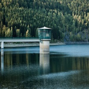
Thuringia is not only beautiful, its people are down-to-earth and likeable and its cities are steeped in history. Thuringia also has a high density of large and interesting reservoirs that are many years old and have long since blended positively into the landscape.
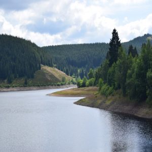
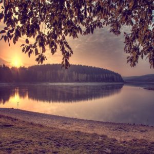
Nature has come to terms with man there and so the local recreationist can find beautiful landscapes around the dammed rivers.
Hast Du Dir schon einmal überlegt alle Thüringer Seen zu Fuß zu umrunden? Mach es!…. es wird sich lohnen. So kannst Du Dir die schöne Sammlermedaille der Iron Lake Challenge in der Edition „Thuringia“ verdienten. Es warten ca. 200 Kilometer wunderschöner Uferstrecke auf Dich!
RULES
The rules for the Iron Lake Challenge Thuringia are very simple. Nevertheless, we would like to clarify them again at this point:
- Register for the Iron Lake Challenge Thuringia (Klick auf das Logo weiter unten)!
- To conquer this challenge and get the beautiful collector's medal "Thüringen edition” zu verdienen, musst Du die zehn größten Seen in Thüringens zu Fuß umrunden.
- Bicycles, skates, etc. are not allowed, but you are welcome to hike or run.
- Each lake must be circumnavigated "in one piece". This means that you are welcome to take breaks, but you should complete the lake within one day, unless there is a special regulation. Of course you can divide the 10 lakes into different days. Do only one lake per day, because you want to enjoy this time!
- You have as long as you want for the ten lakes. You don't have to go around them within a year. You should enjoy and not rush!
- We trust you that you have really circumnavigated the lakes. However, if you want to be included in the time ranking, we need a copy of your tracking. We don't care what you use (watch, smartphone or app).
General PLEASE NOTE!
- Please note that the Road Traffic Act applies in public traffic areas and along roads and cycle paths. So move considerately.
- You circumnavigate the lakes at your own risk and at your own risk. The operator of this website assumes no liability.
- Please heed medical advice if necessary or have a medical examination before the start of the Challenge. You are responsible for your own health, equipment and condition. Breaking off a tour is not a disgrace, health always comes first!
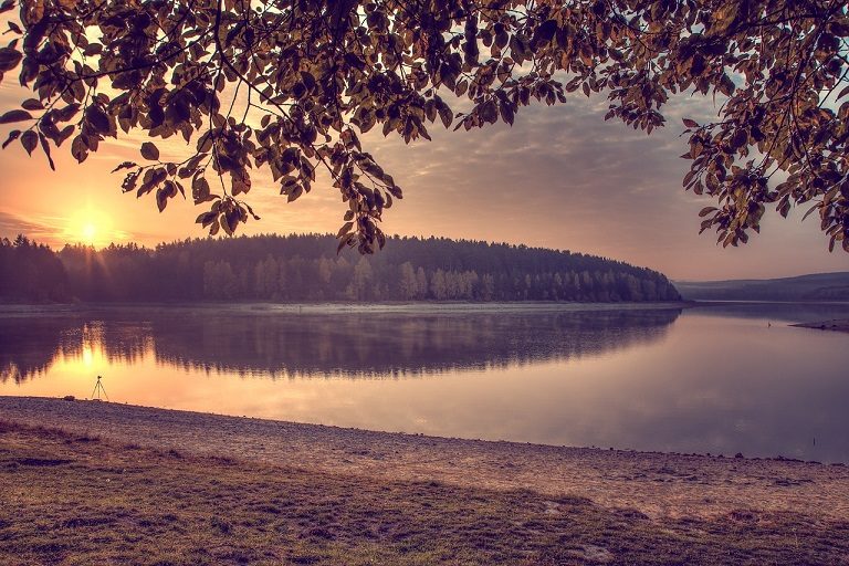
A few rules for dealing with nature during your lake tour:
- Please take into account the local instructions for the protection of nature.
- Please do not go off the trails.
- Please do not make noise.
- Please do not collect rocks or minerals.
- Please do not collect mushrooms.
- Please do not leave trash lying around.
- Please do not feed animals.
- Please do not make an open fire.
- Please do not pick plants.
This should be obvious to all of us, but it doesn't hurt to remember it from time to time.
REGISTRATION AND SCOPE OF SERVICES
The registration for the Iron Lake Challenge Thuringia costs you 24,- EUR.
In this entry fee is our Iron Lake Challenge “Thüringen” Sammlermedaille and the green marble (25mm) of the Timeless Challenge .
However, for this you must first go around the ten largest lakes in Thuringia! Only then we will send you the well-deserved medal and marble! After all, you want to earn them and not get them as a gift.
With your registration fee you support my heart project of the Reforestation of one million trees worldwide!
How to register:
- Klick bitte auf das Bild unten und Du wirst zur Anmeldeseite unseres Partners Digistore24 geleitet
- You will now receive a registration confirmation
- Now you have to walk around the ten largest lakes in Thuringia. As soon as you have completed them, please send us an excerpt of your tracking as proof.
- After we have checked this, you will receive your well-deserved medal and marble. Easy, isn't it?
YOUR MEDAL AND YOUR MARBLE
If you have walked around the ten largest lakes in Thuringia, then you have earned the beautiful Iron Lake Challenge medal in the edition "Thuringia". This can be the first in your upcoming Iron Lake Challenge collection or can be added to your existing collection.


LIFE SCORE POINTS AND THE TIMELESS MARBLE
The Iron Lake Challenge is part of our Timeless Challenge. Therefore, you deserve (in addition to the collector's medal) the marble in green (health/sport). This will also be sent to you. The marble will have a diameter of 20mm.

You earn with your performance approx. 16 Life Score points. Diese werden sowohl der Ehrentafel Thüringen, als auch dem Life Lake Museum credited. This service is free of charge for you.
The ten largest lakes in Thuringia
Finding the ten largest lakes in Thuringia was not that easy. For example, the Straußfurt flood control reservoir should have been included in this list, but it is completely dry for large parts of the year, so it is not interesting. And then there are numerous lakes that are located on the border to neighboring states, so not exclusively on the ground of Thuringia. But we think that the following lakes are exceedingly attractive and a circumnavigation will create many good life moments.
Dam Bleiloch
The Bleiloch reservoir dams the water of the Saale and has the largest capacity of all reservoirs in Germany. It owes its name to the former lead holes that used to stand in the reservoir area. It is the largest reservoir in Thuringia. For a circumnavigation on foot you have to cover about 22 kilometers.
Suggestions for tours around the Bleiloch Dam:
Hohenwarte Dam
The Saale River is also dammed in the Hohenwarte Reservoir (Hohenwarte Dam). During the construction of this dam, about 250 people had to be resettled at that time (in 1930). It is the fourth largest dam in Germany. Its banks are more than 70 kilometers long, so you have three days to walk around it. By the way.... the circular route has almost 2000 meters of altitude! That is a real challenge.
Suggested tours around the Hohenwarte Dam:
Zeulenroda dam
The Zeulenroda Dam is one of two drinking water dams in the Thuringian Slate Mountains. Unfortunately, this dam also has a sad history. When the bridge over the reservoir to Quingenberg, which was under construction, collapsed in 1973, four workers lost their lives. For a circumnavigation you have to cover about 19 kilometers.
Suggestions for tours around the dam Zeulenroda
Windischleuba Dam
The Windischleuba Dam impounds the Pleiße River in the Altenburger Land district. Visitors are in a colorful bird world that is worth seeing. The path around the dam is about seven kilometers long and passes among other things between reservoirs of the dam, so that you have quite a lot of water around you.
Suggested tours around the Windischleuba Dam:
Leibis-Lichte Dam
The Leibis-Lichte dam was built to secure the drinking water supply for the population of eastern Thuringia. At that time, about 100 people had to be resettled from Lichte to the new village Neu-Lichte. The dam is still relatively new, because it was inaugurated only in 2006. A walk around the dam offers you about 20 kilometers of enjoyment.
Suggestions for tours around the dam Leibis-Lichte:
Seebach dam
The Seebach dam is located in the Unstrut-Hainich district. The Singelbach is dammed with the barrage. The dam provides most of the water for vegetable crops (cucumbers and cabbage) in the Unstrut region. You are in for between seven and ten kilometers (depending on the tour you choose).
Suggested tours around the Seebach Dam:
Dachwig dam
Die Talsperre Dachwig liegt zwischen nordwestlich von Erfurt in Thüringen. Sie wurde zur Bewässerung von landwirtschaftlichen Flächen gebaut und und hat heute zusätzlich eine wichtige Naturschutzfunktion als Rast- und Brutplatz für Wasser- und Singvögel. Gestaut wird der Jordan (der Bach „Jordan“). Bei einer Umrundung musst Du ca 6 bis 10 Kilometer Uferstrecke zurücklegen (je nach gewählter Tour)
Suggested tours around the Dachwig dam:
Dam Heyda
The Heyda Dam impounds the Wipfra River in southern Thuringia. It was built for irrigation purposes, but now also enjoys a high recreational value for local recreationists and anglers. In the south it borders on a nature reserve. Its circular trail (approx. 7.6 km) is well-known and popular.
Suggestions for tours around the Heyda Dam:
Schönbrunn Dam
The Schönbrunn Dam is located about 20 kilometers south of Ilmenau and dams the river Schleuse. The Schönbrunn dam supplies 230,000 consumers in southern Thuringia with drinking water. There is a circular trail around the dam with a length of about 15 km, which is excellent for walking or hiking.
Suggestions for tours around the Schönbrunn Dam:
Weidatal dam
Die Weidatalsperre ist eine von zwei Talsperren an der Weida, im Thüringer Schiefergebirge. Die oberhalb von ihr liegende zweite Talsperre ist die Talsperre Zeulenroda (ebenfalls in unserer „Top10 Thüringen“). Die Talsperre dient dem Hochwasserschutz und der Niedrigwasseraufhöhung. Eine Umrundung erfordert ca. 14 Kilometer.
Suggested tours around the Weide Dam:
THE IRON LAKE CHALLENGE IN SOCIAL MEDIA
Join our forum
Exchange ideas in our community! Our forum for experiences, reports, questions and more

HASHTAGS OF THE IRON LAKE CHALLENGE
We would be happy if you share pictures, videos and your experiences around the Iron Lake Challenge with others. For this purpose we provide you with the following hashtags:
- #ironlakechallenge
- #ironlakechallengethueringen
- #timelesschallenge
The IRON LAKE CHALLENGE ON FACEBOOK
Of course we also invite you to join our Facebook group "Iron Lake Challenge Discussion Board".
IRON LAKE CHALLENGE Thuringia HONORARY
Here you can quickly and easily enter your results and upload the evidence (e.g. screen copy of your tracking). We check them and then release them. Then your result is saved and appears in the honor roll. Be proud of what you have already achieved!
Instructions for the Challenge Tool
This is how our honor board works
- Register on our site
- Select the lake you are circumnavigating under "Summit/Lake
- Enter the distance you have covered (in meters) under "Length / Mountain height (in m)"
- Enter the required time (in minutes) under "Time needed (in min).
- Enter the date of your circumnavigation under "date"
- Now you can upload the evidence (e.g. a screenshot of your tracking) under "Upload proof (optional)"
- Now all you have to do is SAVE!
- We check your round and release it. Then you will see your result in the ranking.
Points
Timeless Shop
In unserem Timeless Shop findest Du auch für die Iron Lake Challenge tolle Produkte. Schau mal rein! Produkte mit folgenden Designs können wir Dir derzeit anbieten:
Darf es noch etwas mehr sein?
 | Iron Lake WORLD Challenge! Hier zählen alle Seen weltweit, sobald die Uferlänge länger als 2 Kilometer ist. |
IMPRINT
22 comments
Leave a Reply
You must be logged in to post a comment.


Ich habe noch eine Frage. Kann man auch Umrundungen verwenden, die vor der Anmeldung erwandert wurden?
U. Nehring
Hallo Ulrike,
die Challenge machst Du für Dich. Deshalb kannst Du das selbst entscheiden. Wenn Du uns den Nachweis bringst, dass Du einen See umrundet hast, dann ist das für uns ok. Das soll kein Wettbewerb gegen andere sein, sondern schöne Lebensmomente bringen.
Viele liebe Grüße,
uwe
Hallo.
Wie kommt es dazu dass man die Talsperre Seebach aufgenommen hat? Es gibt darum keinen Weg!
Thüringen hat so viele schöne und weitaus größere Talsperren dass ich die Auswahl nicht ganz nachvollziehen kann!
Hallo Aileen,
bei der Talsperre Seebach hatten wir lange überlegt, denn Ein Weg rundrum ist tatsächlich nur mit „Umweg“ möglich. Bezüglich der Größe der Talsperre ist sie eindeutig in den Top10 Thüringens. Diese Auskunft hatten wir vom Wasserwirtschaftsamt erhalten. Wir haben die größten Seen nach der Wasserfläche sortiert.
https://de.wikipedia.org/wiki/Liste_von_Seen_in_Th%C3%BCringen
Ich werde (sobald mir weitere Infos zu einer Strecke vorliegen) die bisher begangenen Rundwege natürlich umgehend veröffentlichen.
Viele Grüße,
Uwe
Hallo,
es wäre hilfreich wenn es für die verschiedenen Challange eine Karte gibt, auf der man die verschiedenen Seen sieht übersichtlich sehen kann. Dies wäre hilfreich insbesondere bei großen Bundesländern um bei langen Anreisen festzustellen, ob man an einem Wochenende nahe zusammenliegende Seen zusammen machen kann. Dies ist auch Ökölogisch sinnvoller, als zu du jedem See einzeln anzureisen.
Gruss Michael
Hallo Michael,
vielen Dank für Deine Anregung. Du hast natürlich vollkommen Recht. Eine Karte mit all den Seen die Teil der Iron Lake Challenge sind sollte doch machbar sein und ist hilfreich für alle Teilnehmer. Ich habe die Idee auf unsere „Entwickler-Liste“ aufgenommen, damit wir das beim nächsten Update mit veröffentlichen können.
Danke nochmal und sportliche Grüße nach Thüringen,
Uwe
Hallo!
Ich habe gerade diese Seite entdeckt und finde die Idee total spannend. Auf jeden Fall werde ich mitmachen. Was mir aufgefallen ist: warum ist zum Beispiel die Talsperre Heyda mit gut 7 km Rundweg dabei, aber die Ohratalsperre mit ihren 14 km nicht unter den zehn größten Talsperren?
Viele Grüße!
Holger
Hallo Holger,
vielen Dank für Deine Nachricht. Wir haben die Seen nach der „offiziellen“ der Größe Wasserfläche ausgewählt. Die Talsperre Heyda wird mit 95ha, die Ohratalsperre mit „nur“ 82ha angegeben.
Viele liebe Grüße und einen guten Jahresstart,
Uwe
Hallo,
müssen es die aufgeführten Talsperren sein? Ich habe vor Ort die Schmalwasser, Ohra und Alte Tambacher Talsperre. Diese würden nicht zählen?
Hallo liebe Simone,
die Talsperren in Deiner Nähe sind mit Sicherheit eine Umrundung wert, aber sie können leider nicht Teil der Iron Lake Challenge sein. Wir legen Wert darauf, dass die zehn größten Seen eines Gebietes (Bundeslandes) umrundet werden.
Viele Grüße und einen guten Rutsch in ein gesundes und glückliches Jahr,
Uwe
Hallo!
Wir haben uns erfolgreich zur Challenge angemeldet und die vorgegebenen Seen umrundet!
Nun wollte ich gern das Tool nutzen um auch in die Zeitwertung aufgenommen zu werden! Ich scheitere allerdings bereits bei der Registrierung! Wo genau kann man sich registrieren?
Vielen Dank für die Unterstützung!
Mit freundlichen Grüßen
Aileen
Hallo zusammen,
Respekt an Aileen und Steffen, aber mal ernsthaft… Weder in 12 noch in 14 Stunden ist es möglich alle 10 Gewässer zu umrunden. Kann es sein, dass da bei der Gesamtzeit etwas nicht korrekt dargestellt wird?
Viele Grüße
Sylvio
Hi Sylvio,
Du hast natürlich absolut Recht. Wir haben da noch ein Bug in der Software.
Viele Grüße
Uwe
Stichwort Hohenwartestausee – hierfür hat man maximal 3 Tage Zeit. Ist es notwendig, die 3 Tage am Stück zu absolvieren oder kann da ggf. auch eine Woche o.ä. zwischen den Etappen liegen?
LG Christina
Hallo Christina,
die drei Tage müssen nicht am Stück sein. Wir haben das ganz oft, dass Leute an einem Tag z.B. 20 Kilometer zurücklegen, dann eine Woche (bis zum nächsten Wochenende) Pause machen und dann an der gleichen Stelle weitermachen. Das ist voll ok.
Viele liebe Grüße,
Uwe
In welchem Zeitraum findet die Challenge statt?Ist dass ich noch 2025 möglich?
Hallo Claudia,
ja. Die Iron Lake Challenge findet laufend statt. Man kann jederzeit einsteigen und es gibt keine zeitliche Begrenzung bis wann man sie beendet haben muss.
Somit geht´s auch 2025 weiter.
Viele Grüße und einen schönen Herbst,
Uwe
Hallo Uwe,
um den Hohenwarte-Stausee gibt es ganz verschiedene Routen. Hier stehen etwa 70 km, aber bei AllTrails gibt es zum Beispiel eine Route von 60 km, die eben nicht immer die langen Schlangenlinien am Ufer nimmt, sondern manchmal auch die Landzungen schneidet (was ja auch Sinn ergibt). Ist diese Route dann genauso gültig? Nicht, dass wir uns zwei Tage dafür nehmen und es zählt dann nicht.
LG,
Lukas
Die ist genauso gültig. Wir haben nur Vorschläge veröffentlicht. Wenn Du einen besseren Weg findest, dann passt das auch.
L.G.
Uwe
Hallo, habe versehentlich die Länge in Kilometer und nicht in Meter angegeben. Wie kann man das ändern? LG Anja
Habs schon korrigiert 🙂
Hallo Uwe,
ich hatte am 07.09.2025 die Weidatalsperre umrundet, sie ist aber hier in meiner Liste nicht mit aufgeführt.
Ich habe auch gesehen, dass bei anderen, die schon alle 10 Seen geschafft haben, eine „Weidetalsperre“ aufgelistet ist.
In Deinem Beschreibungstext heißt sie allerdings auch richtigerweise „Weidatalsperre“.
Schau bitte noch einmal nach und ändere den Eintrag, sodass diese Talsperre auch bei mir erscheint.
Bei der ILC World ist sie bei meinen aktuell 107 Seen mit dabei, wird aber dort in der Liste auch nicht angezeigt, weil ab dem Buchstaben „S“ alle nachfolgenden Seen abgeschnitten werden, sobald man „Watch all“ anklickt.
Vielen Dank! Harald